Yesterday, Benno and I went on an adventurous trip in our truck into the Patagonia Mountains with destination of the ghost town of Lochiel, located just adjacent or right at the border to Mexico. Of course our doxies accompanied us as usual.
From our Park we took the Arizona State Route 82, and through the little touristy town of Patagonia where I took a photo of an old train wagon which has now become a tourist information kiosk and the old United Methodist Church. Following Hwy 82 we passed by the Nogales International Airport on the left and then we took a left turn at the Little Red Schoolhouse onto the Duquesne Road. Benno was delighted that the road surface was paved and figured the drive to our destination would be a piece of cake.
Well, his delight about the road condition vanished about a couple of miles later as the road became a dirt trail. Although quite wide and sandy we found ourselves bouncing on a washboard surface with potholes and rocks strewn about where you could loose your dentures. Good thing we had new shocks on the front end.
.jpeg) |
| This sign was further along on the Duquesne trail |
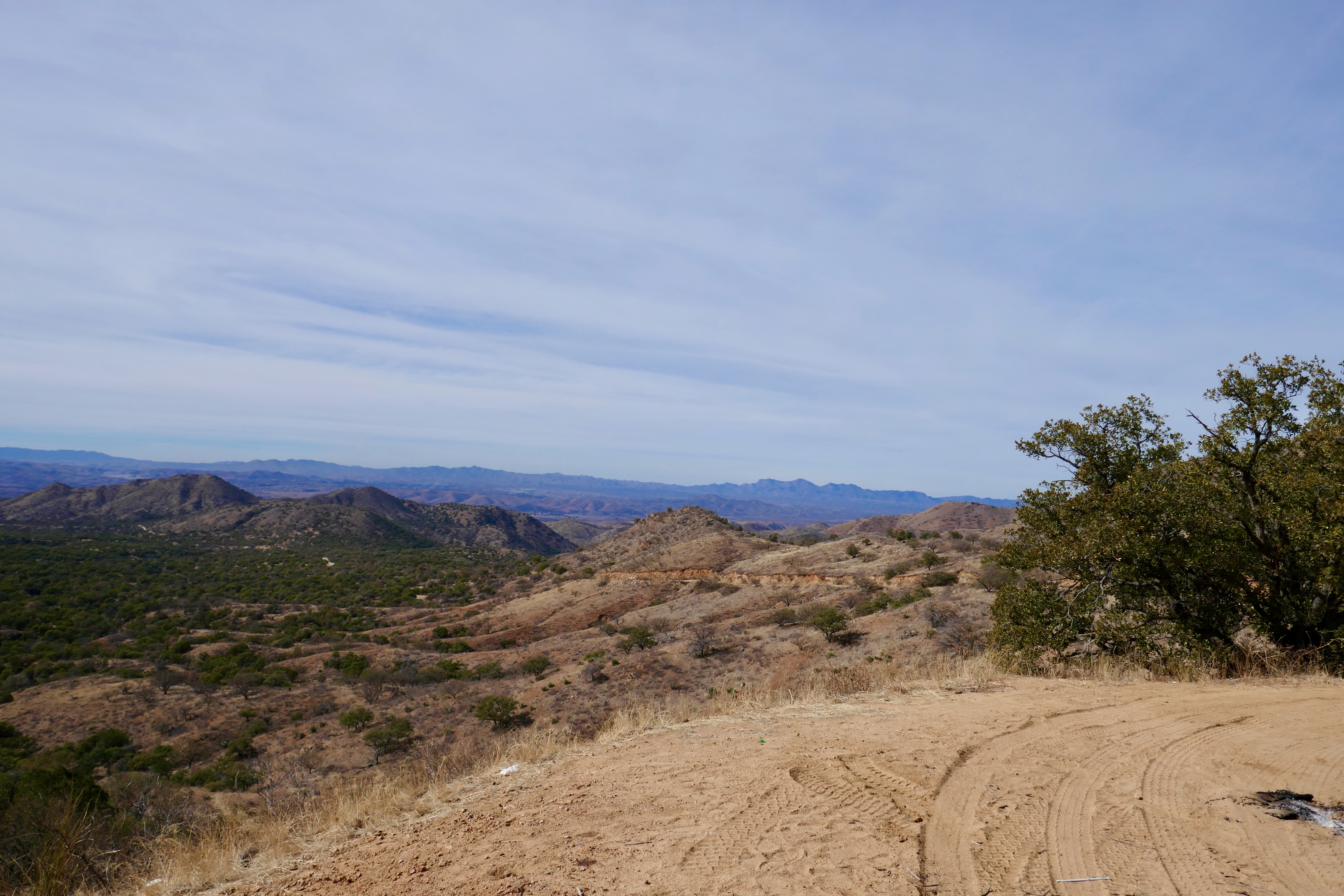
Thinking it might get better, we carried on the trail that continued southeast, sometimes narrowing as we passed many cattle guards. The trail became more winding as we went on and if we thought the trail conditions couldn’t get any worse when snaking up the mountain, we were wrong!
 |
| We stopped and I climbed up to take photos |
 |
| A small outcrop of the road where I could take photos |
Not only did it narrow to an uneven one lane, we were on a continuous climb into the mountains and the higher we got, the more nail biting the drive became. If you are afraid of heights and not driving, maybe wearing dark glasses might help you. :-)
 |
| The road were we came on |
Back at the RV Park the temps were 22C/72F, but in the mountains we were at 17C/62F with remnants of snow in the shady parts. There were areas where Benno let the truck just roll through the icy and muddy ground in sharp curves to avoid any slipping. All went well, but I do not know if Benno’s hands got sweaty?
 |
| Look closely the road we came from on the upper right of the photo |
I must say the views were spectacular. However, not many spots to pull off for photo ops, but I managed to snap some. I believe the most spectacular were of the San Rafael Valley.
 |
| A tower with camera in the middle of nowhere |
Driving downhill was just as exciting as going up with many twists and turns and sometimes such a horrible trail surface that had me gripping the door handles on tight as we bounced along. There were mining ruins of the Washington Camp but too steep uphill to visit.
 |
| The historical landmark we were looking for |
 |
| Inscription of the historical landmark |
Perhaps after 15 miles or so, almost ready to give up and wanting to turn around, we spotted the Fray Marcos de Niza Historical Landmark and straight ahead were the remnants visible of the little town Lochiel that consisted of the old schoolhouse, church and a couple of abandoned houses. The fence and abandoned Mexican border patrol house were only a couple of hundred yards further.
 |
| Pavilion and sign of the schoolhouse to the left |
 |
| View from the inside of the pavilion |
 |
| Inside the old schoolhouse looking through the dirty window |
We ate a muffin and drank our coffee that we brought long at the Patagonia Museum, which sits next to the old schoolhouse and is basically just a pavilion with posters on the walls.
Then we hopped back onto the truck for the return trip. Knowing what was ahead helped to settle our nerves. There were a bunch of cattle grazing in the open grasslands and we spotted two deer that ran from us. Luckily I managed a quick shot with my camera before they vanished. Up on the mountains we encountered two 4x4 vehicles driving in the opposite and for one pick up truck we had to back up on a tight curve to let it pass as he was coming down. Downwards vehicles have the right of way under these circumstances. Hidden in a valley we spotted a border control pickup truck with its officer munching on a donut.
 |
| Cattle grazing in the wilderness |
 |
| A couple of deer before they took off |
It was a lovely outing and we would do it again in a heartbeat.
 |
| Back home showing the evidence of the mountain mud |


.jpeg)

.jpeg)


What a cool and interesting area. I loved your adventure, looks like one we would like for sure!
ReplyDeleteWe might go back to the area for some hiking
DeleteMany of the hidden treasures of the southwest are on roads such as that one.
ReplyDeleteYou mentioned being close to the Border. That's why the Camera on the Tower.
I'm sure the Doxies, did not enjoy the ride.
Be Safe and Enjoy your adventure.
It's about time.
Yes, the cameras can see more than the ground patrols. The doxies were riding on a nice and soft cushion and didn't complain ;-)
DeleteIt sounds like you enjoyed it and your destination was the reward for bracing through the rough road!!
ReplyDeleteThere are some really nice views up in the mountains and next time we'll explore on foot!
DeleteBeautiful blog
ReplyDelete